| Theme | Industry 4.0 |
|---|---|
| Project title | Access to Public Spaces via 5G (5GAPS) |
| Project duration | 01.01.2022 – 31.12.2024 |
| Video | |
| Project website | https://5gaps.de/ |
| Download | |
| Press release |
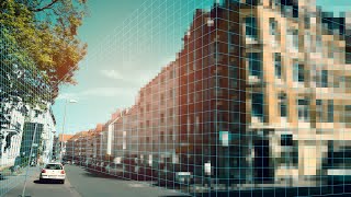
A high-precision positioning system for public and semi-public spaces is being developed in the 5GAPS (Access to Public Spaces) project. This will enable numerous new applications in the future – from highly accurate 3D positioning and navigation even in buildings, to more efficient space management in business and public spaces, to augmenting spatial perception with tracker-independent augmented reality services.
The 5G mobile-based, highly accurate and temporally dynamic positioning system is based on a digital twin of public and semi-public space in the form of a three-dimensional grid: the 5G Open Cubelet Attribution and Positioning System (5G OCAPS). The added value of the approach lies in being able to address each cube ("cubelet") in real time and digitally attribute it – for example, material characteristics, abstract usage rights or colors. This attribution is done temporarily with adaptive grid resolution and accuracy. The 5G network is necessary for the transmission of these data volumes.
In the project, among other things, the sensor systems for environmental data acquisition and the simulation environments will be built and implemented according to the requirements of initial UseCases to ensure data transfer and processing. Based on this, an initial environment will be implemented in 5G OCAPS, using various interfaces to process the data streams and exchange cubelet data packets (position, property, timestamp).
5GAPS will measure a "public" space for its prototypical applications on the 5G campus of Deutsche Messe AG, consisting of a hall and parts of the outdoor area. Selected, 5G-critical pilot use cases ranging from area and logistics management to the use of unmanned aerial vehicles and AR usage will be tested for their functionality and utility. In parallel, an open "crowd innovation ecosystem" will be established to promote crowd-based data mining and management as well as innovative business models.
Publications about the project
This article examines the use of point clouds as a geometric data basis for factory planning and compares different mapping techniques for generating these point clouds. Data and information acquisition is a crucial step in factory planning and thus in developing efficient production processes. In this context, different mapping techniques are analysed: photogrammetry (using drones and action cameras) and LiDAR scans (performed both from drones and from the ground).
The methodology and results of this investigation are discussed in detail, highlighting the advantages and disadvantages of each mapping technique. The focus is on comparing the generated point clouds in terms of completeness, recognisability and geometric tolerance. This comparison provides valuable insights into which technique is best suited for the data acquisition of factory planning.
The outlook of this paper includes the further development of recording techniques, particularly with regard to autonomously flying drones. In the future, these could enable more efficient and precise data acquisition for factory planning and thus further strengthen the basis for optimising production processes.
drone, photogrammetry, LiDAR, point cloud, factory planning, data acquisition
The digital development of spaces within the city of Hannover by means of a digital image makes it possible to cover the usage needs of spaces more efficiently and in line with the requirements. The crea-tion of a digital image, which develops new possibilities for access to public space, requires the use of different sensors such as LiDAR sensors and tracking cameras. In order to select suitable sensors that can be used with UAS, the requirements for the overall system are first defined, which are derived in functional requirements for the sensor technology. Subsequently, the degree of fulfilment of the functional requirements by the different sensors
5G, UAS, digital image, digital twin
Jobs
-
Factory planning, Automation, Digitalisation
Student job, Project thesis, Internship
-
Student job, Internship