

| Theme | Industry 4.0, Factory planning |
|---|---|
| Project title | Development of an automated 3D-layout-acquisition technology to facilitate factory planning processes (Instant Factory Maps) |
| Project duration | 01.01.2017 – 31.08.2019 |
| Video | |
| Download | |
| Press release |
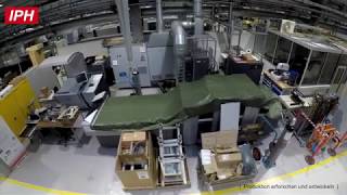
Factory planning projects are time-consuming and complex. The data acquisition and analysis within the framework of the basic evaluation itself takes up to 50 percent of the project effort. Particularly the determination of the current factory layout with its different areas – e.g. stores, allocation, machines or functional areas – takes a lot of time since often no detailed and current layouts are available and the areas need to be measured by hand. Due to the high expenditures of time and costs, SMEs are often not interested in factory planning or the optimization of their factory layouts. Furthermore, 3D-planning can only be realized with great effort, which enables a better imagination and therefore better results.
To simplify this process, technologies are required for fast and low-cost data acquisition and analysis in the factory planning process. A drone-based automated 3D factory mapping could reduce the time and effort required to enable three-dimensional planning.
The aim of the research project is the development of an automated 2D- and 3D-layout-acquisition technology. For that purpose, a semi-autonomous UAV is to be used, to acquire 2D- or 3D-aerial images. An automated stitching or mapping algorithm can match the images together and create a scale image of the factory layout. The automation will also be able to interpret the scanned layout, e.g. detection and measurement of different functional areas. The acquired data can then directly be used for factory planning, e.g. creating digital 3D-images or physical 3D-printed images.
- Sorry, no events available.
Vergangene Termine gefunden
- 27.06.2017
- Seminarraum des IPH, Hollerithallee 6, 30419 Hannover
- 08.03.2018, 10:30 h - 14:30 h
- Hollerithallee 6, 30419 Hannover
- Seminar room, 1st floor
- 27.02.2019, 10:30 h - 14:30 h
- Hollerithallee 6, 30419 Hannover
- 28.08.2019, 09:45 h - 15:00 h
- IPH (Seminarraum), Hollerithallee 6, 30419 Hannover
Publications about the project
The structured and future-orientated planning of factory layouts is an important factor in maintaining a company's competitiveness. The basis for planning is a daily updated recording and visualisation of the factory environment. Current mapping methods require a great deal of manual labour and time for this process, are limited in their flexibility of use and do not represent the process holistically. In this thesis, a novel factory layout recording method using a drone is investigated. Photogrammetric recordings and automated data processing are used to map the recording process holistically and enable planning during the recording. Automation approaches and greater flexibility can be used to make the factory layout recording process more efficient, less costly and more structured.
Factory layout planning, UAV, segmentation, 3D model, automation
Factory planning is an important tool for
manufacturing companies to raise their efficiency and to
maintain their competitiveness by changing market or
customer requirements. A special challenge is the acquisition
of layout data and the processing of this data in suitable
planning tools. Current approaches still measure manually
or have to transfer acquired data from laser scanners by
hand into planning tools, which leads to a high effort and
error proneness.
This paper presents a holistic concept for automated
and systematic data acquisition and processing for factory
planning processes.
3D factory planning, automated drone flight, point cloud processing, 3D layout scan
The structured and future-orientated planning of factory layouts is an important factor in maintaining the competitive ability. However, conventional planning methods with 2D Layouts reach their limits because they can no longer map the increasingly complex factory structures in detail. Alternatives are offered by 360° environmental scanning methods, which currently only serve as a template for postmodeling. This article presents a method for planning directly in the factory image. The aim is to make the factory planning process more effective and less error-prone.
3D-factory layout, factory planning, production planning, point cloud, point cloud processing
Drones are often used in outdoor areas. Though drone are able to do more, e.g. to measure and digitalize the indoor layout structure of production environments. Further more it is possible to plan the production structure directly in the digital model with image processing algorithms. The combination of both step allows a faster and more efficient production planning process.
drone, layoutscan, production planning, digitalization
Abstract: For factory planning projects the layout capturing and layout processing process need a huge amount of effort, because they are typically done by hand. These processes could be accelerated and optimized by using a drone and automated analysis algorithms. Furthermore, this article shows a way to raise the digitization level for industrial processes. The key aspect lies on the usage of a drone in indoor environment and the processing of three-dimensional point cloud models for factory planning processes.
drone, factory planning, 3D-factory layout, object recognition
Structured factory planning is a key to ensure the competitiveness concerning to the increasing pressure from globalization and the high market dynamic. Companies though avoid to do factory planning projects, because of the high effort. For this reason, the processes of factory layout capture and factory layout assessment are in need of improvement in order to increase the efficiency, which will be achieved through new technologies and a semi automation of the processes.
factory planning, drone, photgrammetry, laserscan, image data processing
The article deals with the development of an automated 2D- and 3D-layout-acquistion technology. For that purpose, a semi-autonomous UAV is to be used, to acquire 2D- or 3D-aerial images. An automated stitching or mapping algorithm can match the images together and create a scale image of the factory layout. The automation will also be able to interpret the scanned layout, e.g. detection and measurement of different functional areas. The acquired data can directly be used for factory planning, e.g. creating digital 3D-images or physical 3D-printed images.
drone, threedimensional factory layout, object recognition in point clouds, factory planning
Future factory planning projects are much easier and cheaper than today. With a drone it es possible to scan a factory layout during the flight in a short time. To achieve this benefits, researchers of the IPH are developing a new factory planning method.
drone, threedimensional factory layout, object recognition in point clouds, factory planning

